Serving the Intermountain West
Accurate data. Fast. Every time.
High-accuracy drone LiDAR mapping, topographic data collection, stockpile volume surveys, and earthwork measurement for survey, civil engineering, construction, and mining firms across Utah and the Intermountain West.
Nothing moves until the data arrives. We deliver dense, accurate point clouds and volume calculations in days — not weeks.

Why it matters
How LiDAR Changes the Game for Survey & Civil Firms
Nothing moves until survey is done — and conventional survey takes forever. It ties up crews, delays design, and creates bottlenecks that cost money every day.
LiDAR changes that.
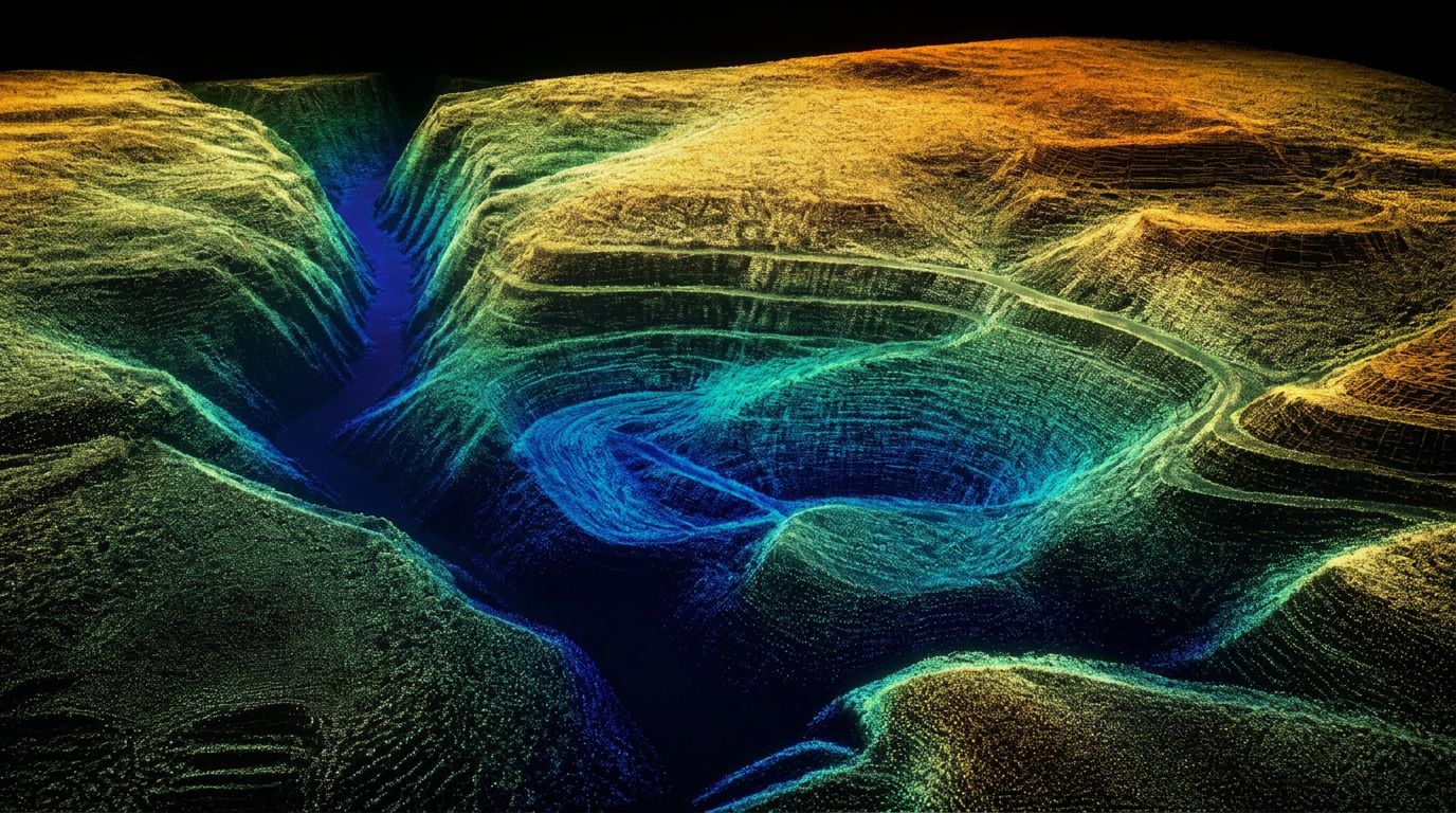
With a Matrice 400 and Zenmuse L3, we collect high-density point cloud data across large areas in a fraction of the time. Combined with RTK ground control from our Emlid system, we deliver:
- Stockpile and pit volume calculations
- Topographic mapping and site grading data
- Pre- and post-construction as-builts
- Earthwork cut-and-fill quantities
- Preliminary CAD linework and breaklines
Your Professional Land Surveyor reviews and stamps. Your design team keeps moving. Projects stay on schedule.
We don't replace your PLS.
We make them faster.
What You Receive
Engineering-Ready LiDAR Deliverables
Every project is scoped around the needs of your surveyor, engineer, contractor, or operations team. Deliverables may include classified point clouds, bare-earth surfaces, contours, breaklines, preliminary CAD linework, cut-and-fill comparisons, stockpile volume reports, and Civil 3D-compatible data.
LAS/LAZ point clouds
Classified, georeferenced point clouds in industry-standard formats.
DTMs and existing-ground surfaces
Bare-earth digital terrain models ready for design and analysis.
Contours and breaklines
Clean contour intervals and breakline capture for grading and drainage.
CAD-ready files
Preliminary linework and surfaces compatible with Civil 3D workflows.
Cut-and-fill exhibits
Visual and numeric comparisons between design and existing surfaces.
Volume reports
Stockpile, pit, and borrow volume calculations with defined base surfaces.
What we do
Our LiDAR Services
Every service below has its own page with scope, deliverables, and answers to the questions clients ask most.
Drone LiDAR Mapping
UAV LiDAR collection producing dense, classified point clouds and engineering-ready terrain data.
Learn more →LiDAR Topographic Mapping
Bare-earth surfaces, contours, breaklines, and CAD-ready DTMs for design and grading.
Learn more →Stockpile Volume Surveys
Repeatable inventory volumes measured against a defined base surface, with cut-and-fill exhibits.
Learn more →As-Built & Existing Conditions
Documentation of completed work and pre-construction baselines, compared against design surfaces.
Learn more →Earthwork & Cut-and-Fill
Cut, fill, and net quantities between surfaces for progress tracking and pay-quantity review.
Learn more →Contract LiDAR for Firms
White-label field capacity for survey and civil firms, coordinated with your PLS.
Learn more →Who we work with
Built for Data-Intensive Projects
Surveyors, engineers, operators, and contractors all need the same thing from us: accurate ground data, fast enough that nothing on the project has to wait for it.
Land Surveying Firms
White-label aerial data collection that works under your PLS, not around them.
Learn more →Civil Engineering Firms
Bare-earth surfaces, contours, and Civil 3D-ready data for design and grading.
Learn more →Mining & Aggregate
Monthly stockpile and pit volumes measured against a consistent base surface.
Learn more →Construction & Earthwork
Progress surfaces, cut-and-fill quantities, and as-built documentation.
Learn more →Land Developers
Early terrain data for feasibility, yield studies, and grading concepts.
Learn more →Energy & Infrastructure
Pad, corridor, and facility data for oil and gas, utilities, and public works.
Learn more →Service Areas
Based in Utah. Mobilizing across the West.
Our LiDAR and RTK kit travels. We're headquartered in the Uintah Basin and regularly fly projects across the Intermountain West.
See all service areas →Frequently Asked Questions
Answers before you scope a project
Clear answers about Utah LiDAR's services, deliverables, project requirements, and service area.
What types of projects does Utah LiDAR support?
Utah LiDAR supports topographic mapping, stockpile and pit volume calculations, earthwork measurement, construction as-builts, existing-condition documentation, and contract LiDAR collection for surveying and civil engineering firms. Common project types include land development, mass grading, mining, aggregate operations, oil and gas sites, roads, utility corridors, and large or difficult-access properties.
What deliverables can Utah LiDAR provide?
Deliverables are customized around the intended use of the data and may include classified LAS or LAZ point clouds, digital terrain models, existing-ground surfaces, contours, breaklines, preliminary CAD linework, stockpile volume reports, cut-and-fill calculations, elevation-difference exhibits, and files compatible with Civil 3D and other design workflows. The exact file formats, coordinate system, surface requirements, and level of processing are confirmed before field collection begins.
How accurate is drone LiDAR data?
Drone LiDAR can produce dense, high-accuracy elevation data when the project is properly planned and controlled. Final accuracy depends on the sensor, flight height, terrain, vegetation, ground control, satellite conditions, processing method, and required deliverables. Utah LiDAR scopes each project around the client's accuracy requirements rather than applying one accuracy claim to every site.
Does Utah LiDAR replace a Professional Land Surveyor?
No. Utah LiDAR provides LiDAR and RTK field-data collection, point-cloud processing, preliminary mapping data, and project-specific deliverables. When a project requires professional land-surveying judgment, certification, or a stamped survey product, the client's Professional Land Surveyor remains responsible for review and approval. Utah LiDAR is designed to give surveyors and design teams denser field data while reducing collection time and project bottlenecks.
Can Utah LiDAR mobilize outside Utah?
Yes. Utah LiDAR is based in the Uintah Basin and mobilizes for qualifying projects throughout Utah, Colorado, Wyoming, Idaho, Nevada, Arizona, New Mexico, and Montana. Scheduling and mobilization depend on the project location, acreage or corridor length, site access, airspace, terrain, weather, control requirements, deliverables, and requested turnaround.
What information is needed to prepare a LiDAR project quote?
To prepare an accurate quote, Utah LiDAR typically needs the project location, site acreage or corridor length, project limits or boundary file, intended use of the data, required accuracy, existing survey control, horizontal and vertical coordinate requirements, requested deliverables, terrain and vegetation conditions, site-access information, and desired schedule. Providing a KMZ, KML, shapefile, CAD file, or marked site map can help define the project area.
- Project location
- Site acreage or corridor length
- Project limits or boundary file
- Intended use of the data
- Required accuracy
- Existing survey control
- Horizontal and vertical coordinate requirements
- Requested deliverables
- Terrain and vegetation conditions
- Site-access information
- Desired schedule
How long does a LiDAR project take?
Turnaround depends on the size and complexity of the site, travel requirements, weather, airspace, vegetation, control, processing, and requested deliverables. Smaller projects may be collected and processed quickly, while large, remote, heavily vegetated, or multi-phase projects may require additional time. Utah LiDAR confirms the anticipated collection and delivery schedule during project scoping.
What is the difference between LiDAR and drone photogrammetry?
LiDAR measures distance using laser pulses and creates a dense three-dimensional point cloud. Photogrammetry creates three-dimensional models by matching features across overlapping photographs. LiDAR is often better suited for bare-earth terrain modeling, uneven ground, and areas with vegetation. Photogrammetry can be useful when detailed color imagery and textured surface models are important. Some projects benefit from using both methods.
All deliverables are provided as preliminary or supporting data. Stamped or permitted use requires review and certification by a licensed Professional Land Surveyor.
Have a project in mind?
Send your location, site limits, deliverables, and schedule
Utah LiDAR will review the scope and recommend a collection approach built around your team's workflow.
Request a Project Quote →